A Bird’s-Eye View in Belize
Ohio Wesleyan Student Uses Drone to Conduct Geography Research
Name: Lucas Farmer ’19
Major: Geography
Hometown: Warrenton, Virginia
Experience: Serving as an International Community Scholar in Belize, funded by the National Science Foundation’s Research Experience for Undergraduates (NSF REU) program.
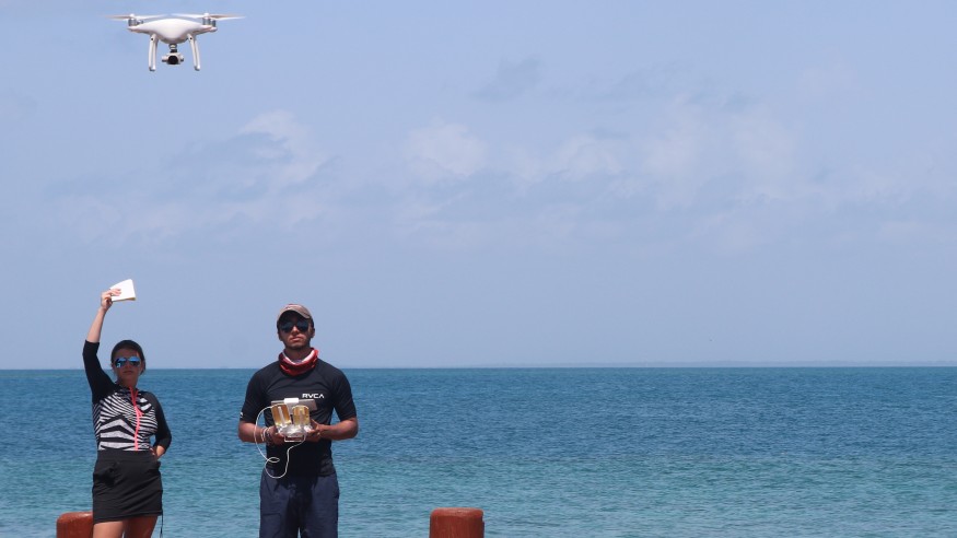
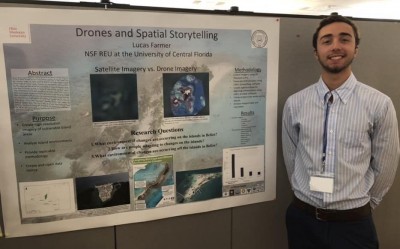
Farmer used drones to map the islands of Belize and conducted interviews with locals to provide context for a spatial storytelling aspect of his project. He presented his research at OWU’s Summer Science Research Symposium regarding environmental changes in Belize and how locals are adapting to those changes. He also has submitted his abstract and poster to present at the East Lakes Division of the American Association of Geographers.
How I became an International Community Scholar
“My professors and mentors – Dr. Nathan Rowley and Dr. John Krygier – within the Geography Department notified me of the project and aided me in the application process. Dr. Timothy Hawthorne was the principle investigator for this REU. (Hawthorne, OWU Class of 2003, is an assistant professor of geographic information systems (GIS) in the Department of Sociology at the University of Central Florida.)
“The project description for the track ‘drones and spatial storytelling’ sparked an interest, and so I decided I wanted to just give it a shot. …
“Out of 547 applicants, I was selected to move forward to an even more exclusive list to be interviewed via Skype. At the end of all the interviews, I was one of 15 students to be selected to be a part of the program and to become an International Community Scholar.”
My research
“I wanted to learn more about how the application of drones can heighten any kind of community GIS, participatory GIS, and remote-sensing projects. The project needed to be more than just drone mapping island, which brought my team to come up with the much-needed spatial storytelling aspect to the project.
“Along with drone flying, we wanted to conduct interviews with locals on the islands and in coastal communities. This qualitative aspect of our research helped give context to our imagery and allowed us to develop a story for these islands and coastal communities. This story helped us reach conclusions and answer our research questions.
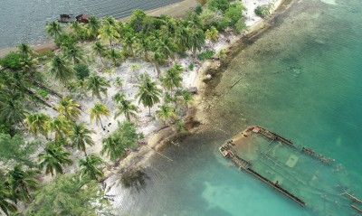
“On our long weekend, two of my teammates and I volunteered to sacrifice our time to work with one of our community partners, Fragments of Hope (FOH). The entire day, honestly, was one of my favorites by far. It was amazing to see the restoration efforts they are doing to help reef system off the shore of Laughing Bird Caye National Park.
“We were also able to map the island and part of the reef system for them, which was a good feeling for me that we were able to help FOH get much need high-resolution imagery of that area. I’m glad I was able to contribute to their cause and to learn more about these vulnerable ecosystems.”
Lessons learned
“Prior to the REU, I had no drone flying experience but was able to pick it up fairly quickly.
“After the REU, I have been able to apply what I’ve learned about drone operations, data organization, data processing, and ArcGIS to current course work and help the Geography Department run the RSL (Remote Sensing Lab). Such knowledge is very important to my future as I would like to be in the field utilizing drones for research or commercial use.
“It was a tough program to be a part of, but I learned many things about the research process and the importance of engaging/involving communities within research.”
My plans after graduation
“I have a couple ideas, but I haven’t quite decided what exactly I would like to do. I definitely want to do something that incorporates my skill with drones and remote sensing, whether that be continuing my academia to grad school or for commercial use.”
Why I chose OWU
“I had originally come to Ohio Wesleyan to compete on the men’s soccer team. Through my time here, I found a course of study that fit my ideal niche within the Geography Department.”