Book by Ohio Wesleyan Professor Guides ‘Making Maps’
 DELAWARE, Ohio – For anyone on a quest to create their own maps, a new book co-authored by Ohio Wesleyan University’s John Krygier can help them chart a successful course.
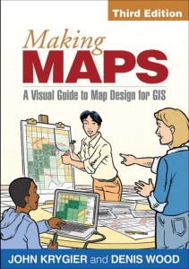
Krygier, Ph.D., an OWU professor of geology and geography, and Denis Wood, Ph.D., a North Carolina cartographer and artist, recently released the third edition of their “Making Maps: A Visual Guide to Map Design for GIS.”
Krygier, whose research specializations include cartography, geographic information systems (GIS), and environmental and human geography, said creating the updated book was “terrible fun,” as the collaborators worked to create a comprehensive and engaging guide devoid of any excess “book junk.”
“I spent over a year and a half producing the maps, graphics, and text for the book, (including) many hundreds of hours of research and production,” said Krygier, who blogs about “do-it-yourself cartography” at makingmaps.net.
Published by The Guilford Press, “Making Maps” covers all components of cartography, including titles, labels, legends, visual hierarchy, data organization, symbolization, and how to turn phenomena into visual data.
Reviewers say the authors succeeded in their map quest to create a book that is both engaging and informative.
Matthew W. Wilson, Ph.D., of the University of Kentucky’s Department of Geography states: “The new case studies and the added emphasis on data captured from mobile digital devices are so relevant to our contemporary discussions in cartography and in geography more generally. … The book is fresh, lively, and engaging – it is a pleasure to read and thought-provoking for students.”
Monica Stephens, Ph.D., of the Department of Geography at The State University of New York at Buffalo, adds: “This book describes the intersection of maps and art. Graphically, the book is beautifully put together. The descriptions of data classification are among the best in any textbook. Readers will come away with a newfound appreciation for well-designed maps.”
Krygier, who also serves as director of Ohio Wesleyan’s Environmental Studies Program, has taught cartography and GIS courses for more than 15 years. He is a past president of the North American Cartographic Information Society (NACIS) and has won national map design award contests for his work. Learn more about Krygier and OWU’s Department of Geology and Geography at www.owu.edu/geography. Learn more about the Environmental Studies Program at owu.edu/sustainability.
Founded in 1842, Ohio Wesleyan University is one of the nation’s premier liberal arts universities. Located in Delaware, Ohio, the private university offers nearly 90 undergraduate majors and competes in 23 NCAA Division III varsity sports. Through Ohio Wesleyan’s signature OWU Connection program, students integrate knowledge across disciplines, build a diverse and global perspective, and apply their knowledge in real-world settings. Ohio Wesleyan is featured in the book “Colleges That Change Lives,” listed on the latest President’s Higher Education Community Service Honor Roll with Distinction, and included in the U.S. News & World Report and Princeton Review “best colleges” lists. Learn more at www.owu.edu.
