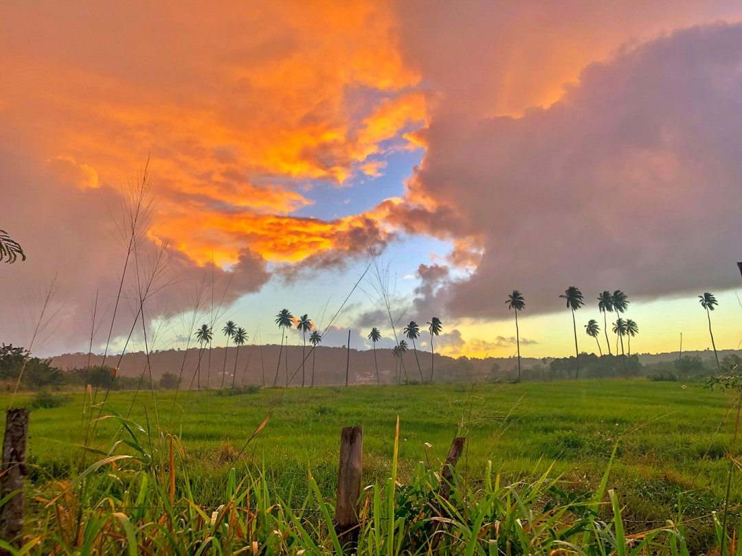
Persevering in Puerto Rico
Earthquakes Shift Ohio Wesleyan Student’s Research Plans

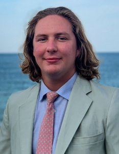
Name: Tommy Jacobson ’20
Hometown: Duxbury, Massachusetts
Major: Geology
Minor: Geography (GIS/Mapping)
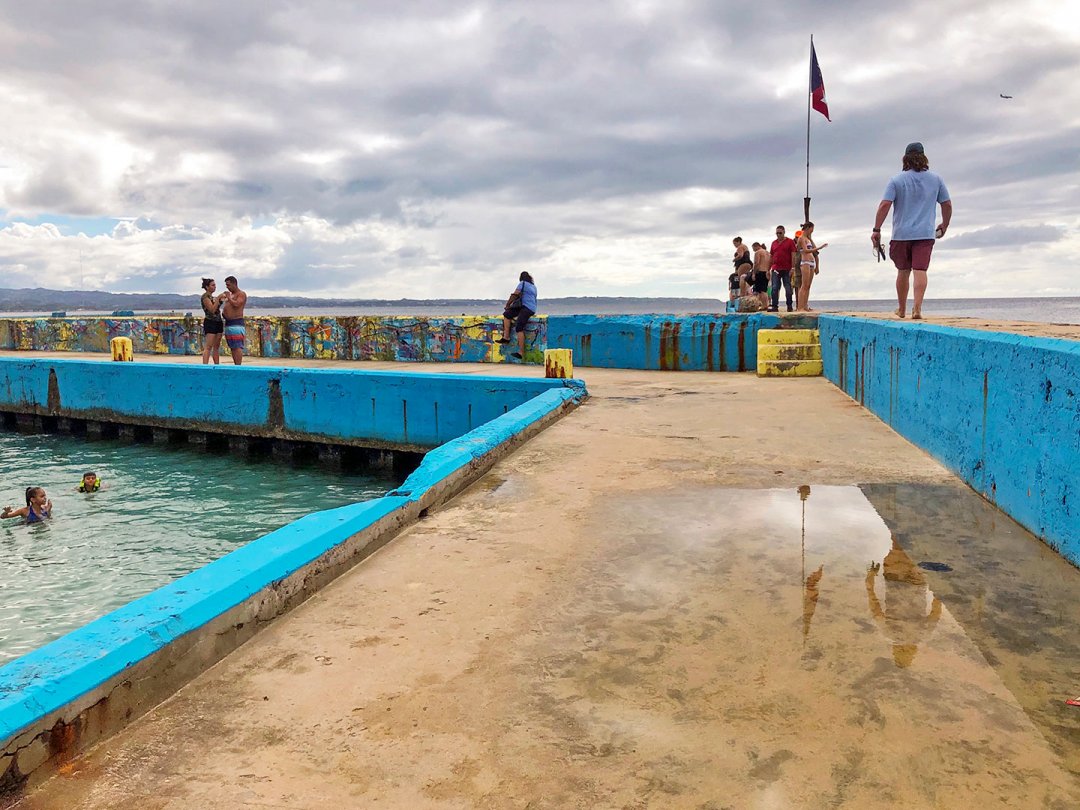
OWU Connection Experience: Geology and Geography Research in Puerto Rico
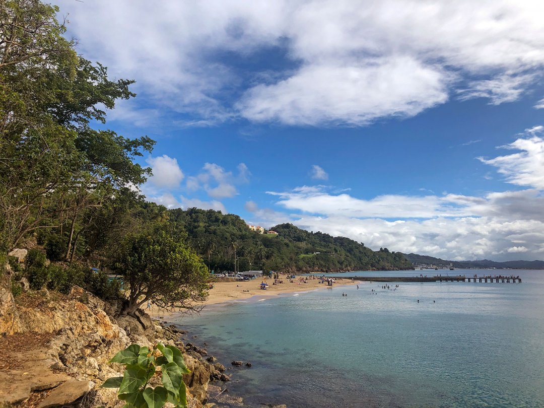
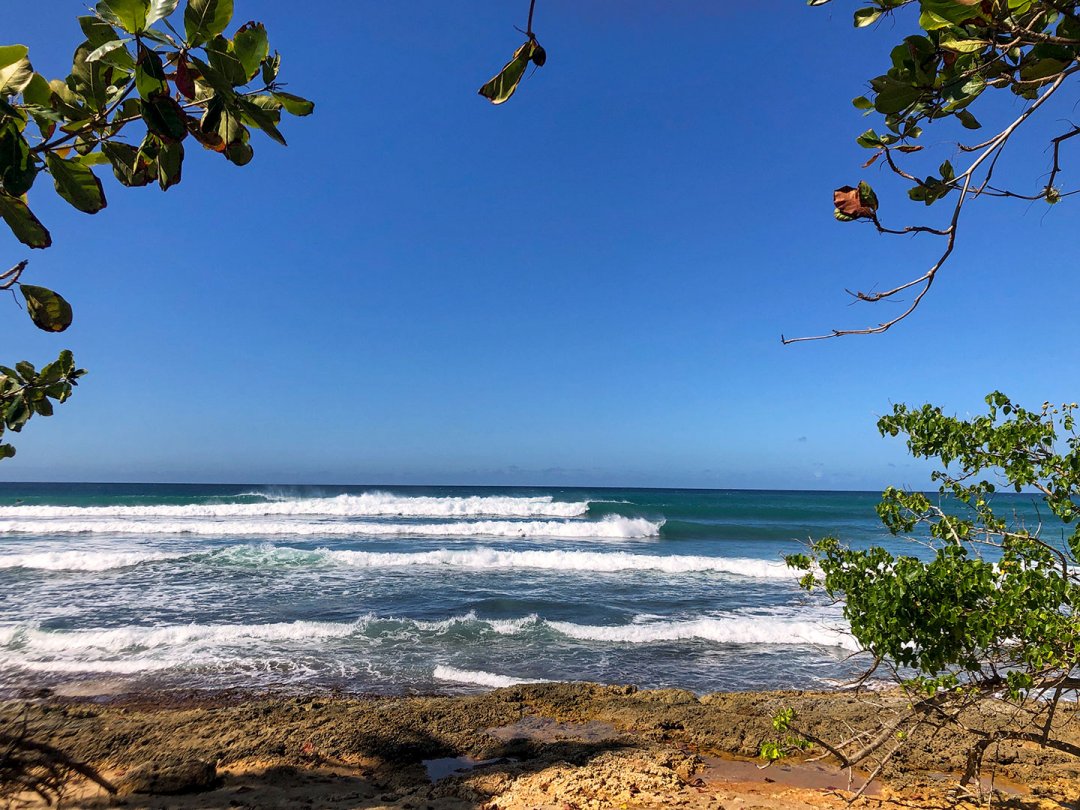
Jacobson earned an OWU Connection Theory-to-Practice Grant to travel to Puerto Rico for nearly two weeks in January to study the causes and effects of coastal erosion and degradation along the Caribbean Island. Earthquakes changed his plan but didn’t prevent him from conducting valuable research during his time on the island.
The Earthquakes’ Impact
“On December 28, a few days before my January 3 departure, I read that the southwest area of the island had been affected by a large earthquake, following weeks of shaking. ... After speaking with my host, I was reassured that everything was OK and that there was little to no damage in the northwest corner of the island, where I would be traveling.
“I remembered my previous visit to the island in March 2018. I remembered how inspiring it was to see how the tight-knit island community had banded together to overcome the many challenges they were left with in the wake of Hurricane Maria. … What sticks with me the most is the gratitude and appreciation that was expressed to us by all of the locals that we met during our time there. They thanked us for the faith that visitors like us had shown them by not canceling our trip and going somewhere else, as thousands of others had.
“After considering this in light of the recent earthquakes, my thoughts were, ‘If spirits were this high less than six months after the deadliest storm to ever hit the island, there is no way a few earthquakes could get those resilient islanders down.’ I made sure to pack the new flashlight that my Auntie Paula had given me for Christmas and didn’t really give it another thought.
“The first major event that I was on the island for came in the early hours of Monday, January 6: a 5.8 magnitude earthquake. … The main effect that this first quake had on me was canceled plans. Among many texts from concerned friends and family, I received a text from one of my local contacts whom I had planned on meeting the following day, asking if I felt the shaking. ‘A bit of disruption due to the quakes right now. … Another 5.8 has the hood walking on eggshells again. Perhaps we can plan something for later in the week,’ the message read.
That night, before going to bed in the basement of the three-story, concrete apartment building that I was staying in, I remembered the flashlight I had packed and placed it next to my pillow. ‘Now that I am prepared, nothing will happen,’ I joked with myself before falling asleep.
The next thing I remember is waking up to my bed shaking enough to start sliding away from the wall, with me in it! In the pitch dark, I could hear the picture frames and decorations banging against the creaking walls, furniture sliding around, and what sounded like a deep rumbling from the ground. I grabbed my flashlight and made a dash for the door.
By the time I made it safely to the lawn area outside the apartment building, the shaking had ceased. I looked to the northeast and saw absolute darkness where many homes and streetlights previously glimmered throughout the hillside. After making some coffee and breakfast on the gas grill with some of the neighbors, the first hues of color started to fill the early dawn sky.
“As it got brighter out, we were able to begin inspecting the building and property for damage. We were lucky as the only visible evidence left behind by the earthquake were the tilted telephone poles resulting from being pulled by the wires and the power outage, but other parts of the island, especially the southwest areas around Guánica and Ponce, did not fare as well. ...
“For the rest of the week, rumors circulated that the earthquake had significantly damaged the power plant and that it could be months before power was restored. I observed many feelings of anger and betrayal directed towards the power company and the (U.S. and Puerto Rican) governments from the Puerto Rican people because of the fragile state of their power grid even after years of rebuilding.”
Shifting My Research
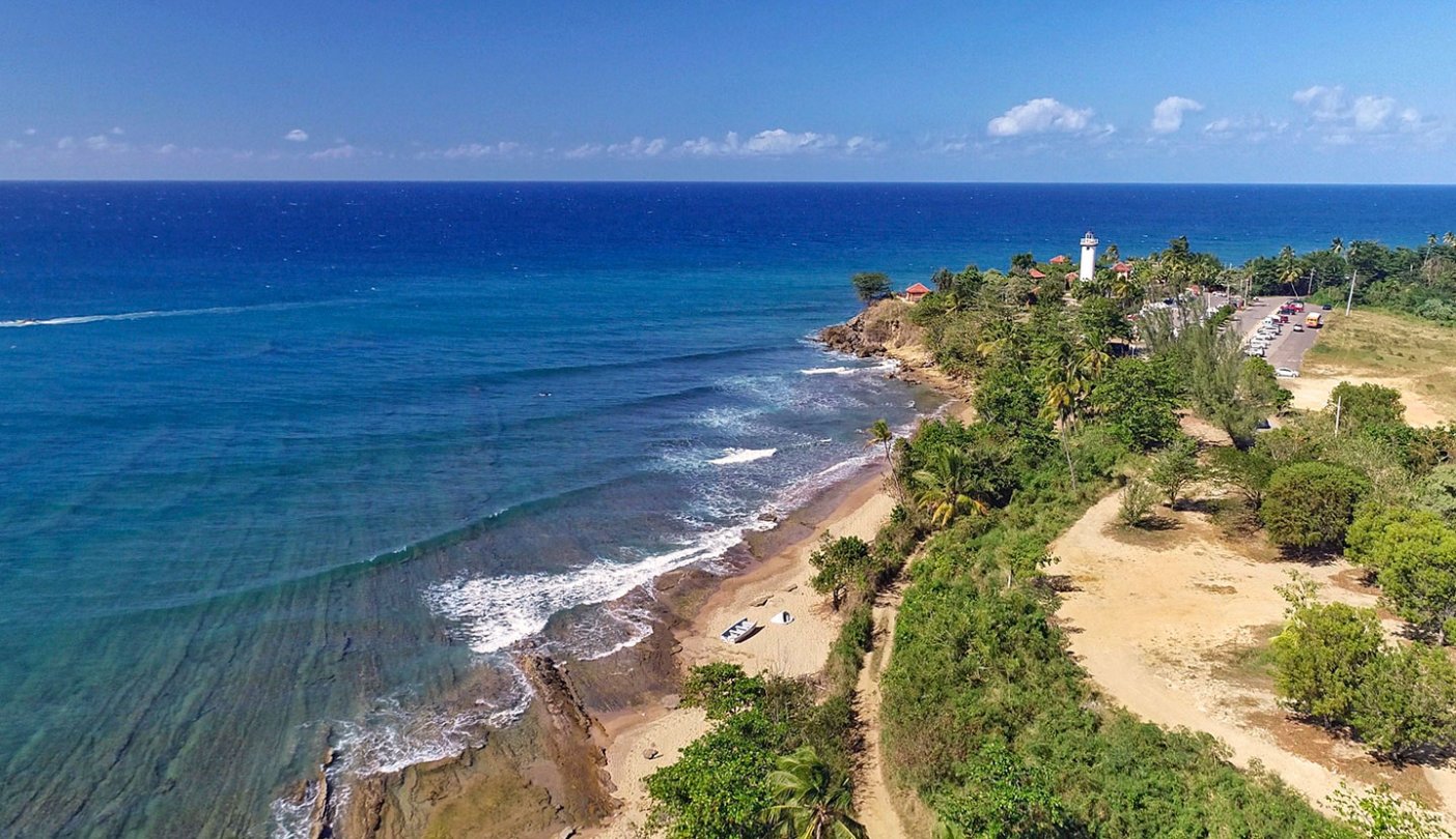
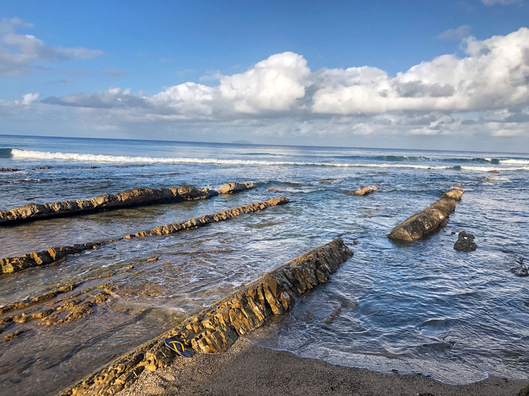
“Without power, I was unable to charge my drone, which resulted in me not being able to collect a lot of the data and imagery that I had hoped to, so I was forced to shift the focus of my studies in order to maximize my time on the island. Initially, I wanted to use the drone to create several high-resolution orthophotos that would be used to identify the varying coastal environments as well as major erosional and depositional trends in order to identify areas of concern associated with coastal degradation. (Orthophotos are aerial photographs that, like maps, are geometrically corrected so that the scale is uniform.)
“Instead, I analyzed the effects of natural hazards on island infrastructures and what risks pose a direct threat to Puerto Rico and its people ... as it relates to building codes, electrical and water grid updates, and natural disaster response planning.”
My Favorite Moment
My favorite moment of the trip was probably the earthquake because I had never experienced one before and because it allowed me to meet my neighbors and bond with them over the experience. Also, shortly after the earthquake, before the sun came up, I looked out over the ocean to the north and noticed a bright string of lights rising into the dark, early morning sky.
“I had never seen anything like it and tried to make sense of it. ‘Maybe the earthquake woke up some aliens,’ I joked. After a few Google searches, I realized that I was seeing 60 satellites from the SpaceX Falcon 9 Starlink 2 launch ascending into orbit after it launched from Kennedy Space Center in Cape Canaveral, Florida.”
Why I Chose This OWU Connection Experience
“Growing up in coastal Massachusetts, I have had an affinity for the ocean from an early age, so when planning my project, I knew that I wanted to use my geology background to research something along the coast.
“During the fall, I was studying coastal processes in Dr. (Keith) Mann’s sedimentology and stratigraphy course as well as map making and remote sensing in Dr. (John) Krygier’s cartography and GIS course, so I was already thinking about how the two disciplines interact when I realized that this project would be a great chance to demonstrate this relationship.”
Lessons Learned
“This experience taught me many valuable lessons about the research process as a whole. From identifying a problem to investigate, to writing the proposal and itinerary only to have to completely replan the trip due to unforeseen circumstances (like an earthquake), this experience gave me the chance to face and overcome many challenges that you would not normally see in the classroom. …
“From the trip itself, I learned a lot about the people of Puerto Rico and how they feel about recent events, the current political climate, and the island’s overall relationship with the United States. I learned how important it is to talk to as many people as you can and to listen, even when you might not agree with what is being said.
“I have always been interested in how the disciplines of geology and geography interact, and this project was a great way to really dive into that intersection. After being unable to collect much of the data that I wanted to, I shifted a lot of my efforts to talking to locals, business owners, and tourists in order to identify a new direction for my research.
One topic that I kept hearing was about tourists canceling their trips to the island in light of the recent earthquakes. … I realized a new opportunity to study the intersection between geology and geography as it relates to natural disasters and government aid through planning, response, remediation, and properly developed infrastructure.”
OWU Faculty Mentors
“Throughout the process, I worked closely with geography professor Ashley Allen to plan my research topic and write my proposal. Being a cultural geographer, she has been pleased, to say the least, with my project’s new direction and increased focus on the human and cultural geographies after hazard events. Dr. Mann was also a big help with any geological questions I had and in preparing me to conduct research.”
Why I Chose Ohio Wesleyan
“I originally chose to attend Ohio Wesleyan after being recruited to play lacrosse here. Due to several knee injuries, I stopped playing and right around the same time I discovered my passion for geology.
“If it were not for the Department of Geology and Geography, I likely would have transferred to a school closer to home but now, two years later, I am beyond thankful that I chose to stay as the teachers in this department have helped me to open up more opportunities than I could have ever imagined.”
My Plans after Graduation
“After graduation, I plan on working in environmental science and am particularly interested in geotechnics and remote sensing.”